Mapping Of Traditional Water Management Structures In Telangana


Telangana as a state is known for its rich heritage and the architectural structures associated with it. The primary ones are the stepwells or more popularly known as baolis. These are water storage tanks which were constructed to be near agglomerations and acted as congregation spaces as well. Over the years of urbanization and the aftermath of climate change, the baolis have dilapidated to a condition that mapping them requires a process to be followed. The attempt for the same has been done by various government and private organisations, few being Greater Hyderabad Municipal Corporation (GHMC), Hyderabad Design Forum (HDF) and The Rainwater Project (TRP).


At The Rainwater Project, the exercise to map as many stepwells in the state was taken up in the month of July 2022. Various sources of data collection were adopted over the period of time with the learnings from the previous ones. The social enterprise which works in the same domain of water management systems, gave the advantage to the already collected data base prepared over the years. The next step was to access information from the other districts of the state. This was done through filling a Google form available in English and Telugu. Hence, people became our partners to identify the stepwells in their vicinity and share information about the same. The results were surprising when the message of this exercise spread to areas of the state and the coordinates were mapped. Overall it was evident that most of these stepwells were present in religious structures and maintained well. The other side was the polluted and ignored state of these architectural marvels.
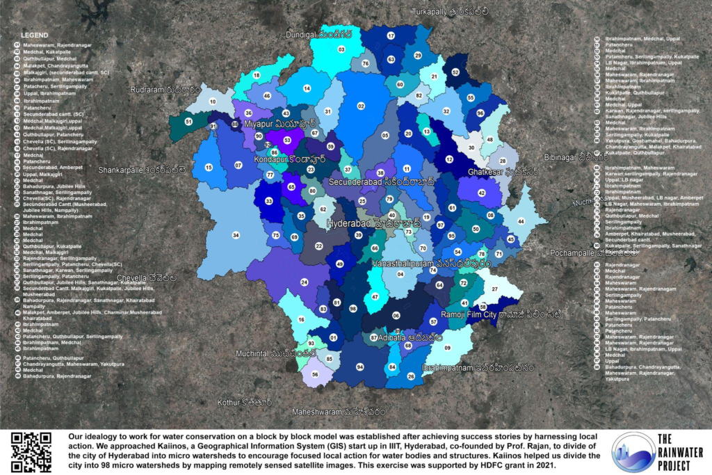
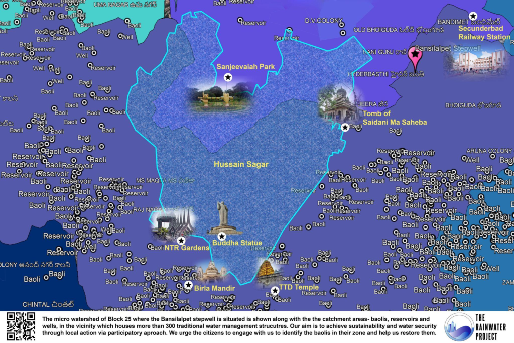
Another data source dated back to the Municipal Maps prepared by Britishers in the 1920’s. Archives were sought out to overlay these on Google Earth with reference to the roads. The nomenclature of these maps was divided into baolis, reservoirs and wells. Using the reference points, the structures were marked with the exact coordinates. The maps currently found cover the densely populated areas of the city including present day city areas around the Char Minar and Musi River. Throughout the process, the commonality found out was the turn of events due to urbanization. The vision was enhanced by the changes in the geography with respect to roads and religious places.

